
London Tube Maps
Early Geographical Maps of Underground Companies
The evolution of London's iconic Tube map is a tale of innovation and design that transformed navigation within this intricate transit system. In the early years, London's transport was a patchwork of independent companies, each with its own map. 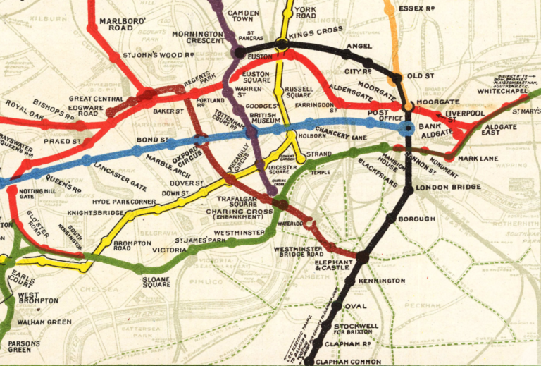
In 1908, the first common map of the entire network was published, using different colours for each line against the background of a geographical map. Nevertheless, the map was visually cluttered and challenging to read. Additionally, to maintain clarity in the central area, lines in peripheral areas had to be truncated. Octolinear Maps of the Underground
Harry Beck, a London Underground employee, recognised that for underground travel, the exact geographical locations of stations above ground were irrelevant. What mattered most was showing the sequence of stations and the directions of the train lines within the underground system. He produced in his own time a simplified, diagrammatic map with lines running vertically, horizontally, or at 45° angles. This style is known as octolinear due to the eight possible directions from every single point. 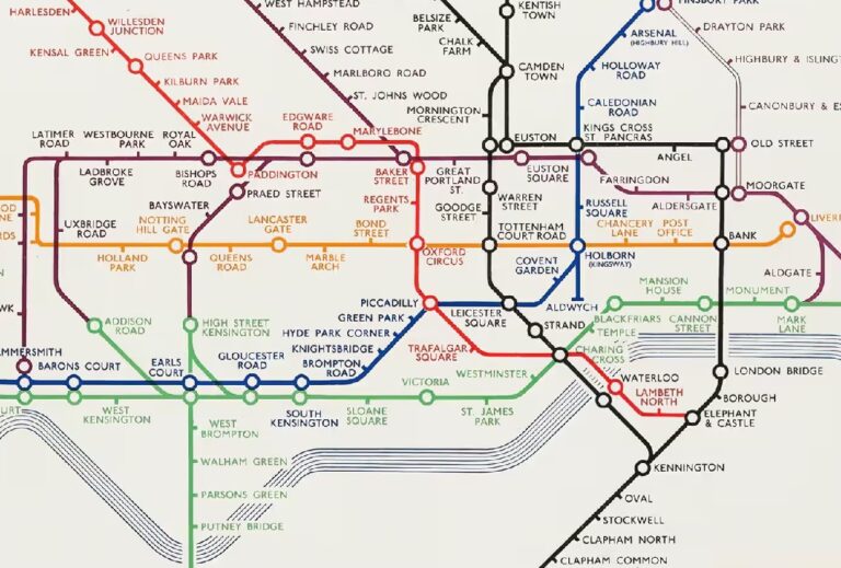
Beck's map quickly gained popularity when it was experimentally introduced to the public in 1933. 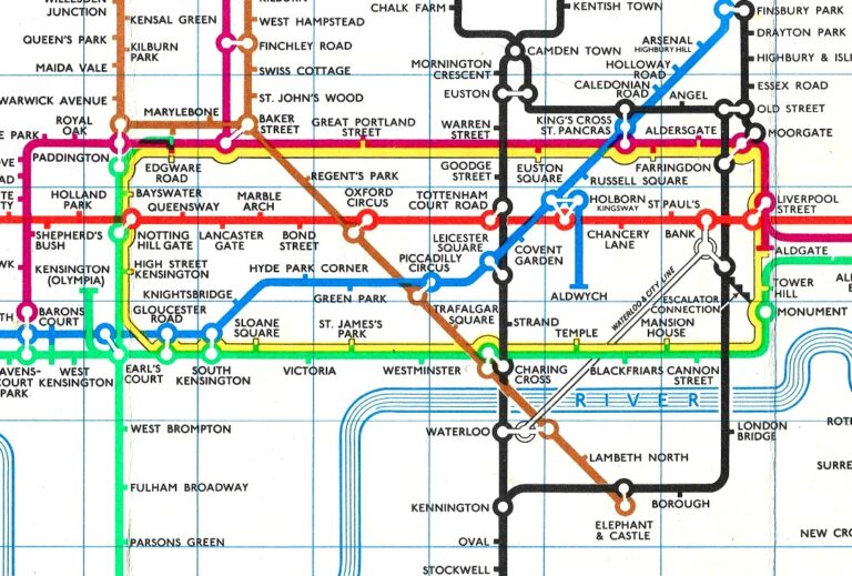
Over the next few decades, Beck persistently updated and refined the Tube map, making it increasingly abstract, even in the central area, and eventually losing the fine balance between clarity and accuracy with his fourth design of 1954-1959.In 1960, Harold Hutchinson, the Underground's publicity officer, decided to personally take over the design to make it closer to geography and easier to read. 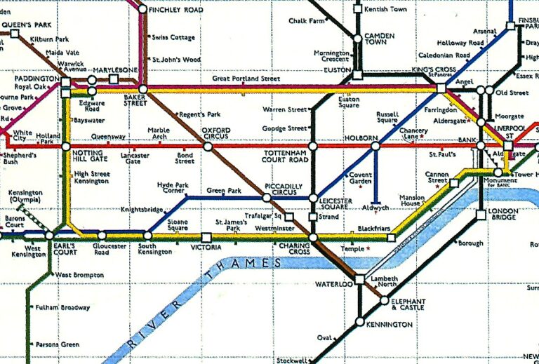
Hutchinson's map included some futile geographical configurations (e.g., the Wimbledon Branch) while distorting geography where it is most significant: the central area. The section between Euston Square and Baker Street was overly dilated, while the area around Aldgate became congested, necessitating the splitting of Aldgate's name in two parts. On the positive side, he introduced interchange symbols that allowed multiple lines to pass through a single circle.

In 1964, Paul Garbutt, also working in his spare time like Beck, produced a map that "rescued the design."
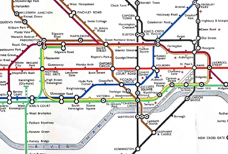
Garbutt adapted elements from Beck and Hutchison's work, adding his own vision of the network centred around the Circle Line, depicted as a "thermos flask." Garbutt continued to update the Underground map for over twenty years while keeping the design relatively stable. He believed that Beck had gone astray over the years and should have stuck to his first design. He was not going to repeat that mistake and cemented his design as the tube map that everyone knows today.Over the last few decades, more and more elements, such as DLR, trams, and fare zones, have been added on top of the existing design (i.e. Garbutt's design modified by Tim Demuth in 1988 and others thereafter), without elaborating a new comprehensive vision of the network. This approach has made the map visually cluttered and incredibly difficult to read. As a result, many alternatives have been proposed, ranging from minimal adjustments (e.g., Cameron Booth) to more comprehensive redesigns (e.g., Kenneth Field), all with the aim of "rescuing the design," once again.
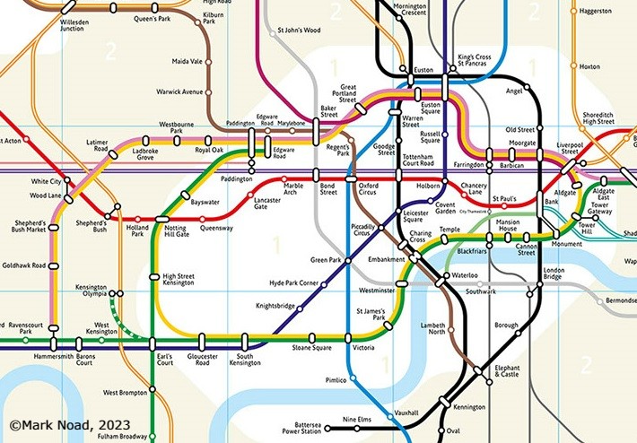
Among the many alternative maps proposed, Mark Noad has suggested a more geographically accurate map, which brings us back to the beginning of this story. External Links: Official Octolinear Tube Maps
♦ Harry Beck's (First) Official Tube Map London Transport, 1933
♦ Harry Beck's (Last) Official Tube Map London Transport, 1959
♦ Harold Hutchinson's Official Tube Map London Transport, 1960
♦ Paul Garbutt's Official Tube Map London Transport, 1969
♦ Current Official Tube Map TfL, 2024
External Links: Alternative Octolinear Tube Maps
♦ Cameron Booth's Tube Map Transit Maps, 2016
♦ Jonathan Farrow's Tube Map L. Raynolds, The Londonist, 2018
♦ Jug Cerovic's (London Traditional) Tube Map Jug Cerovic Architect, 2020
♦ Max Roberts' (Elizabeth Conundrum) Tube Map  Newsletters n.75, Tube Map Central, 2020
♦ Mike Hall's (with Elizabeth Line) Tube Map thisismikehall, Behance, 2020
♦ Peter Ryden's (Future) Tube Map  Project Mapping Central, seen March 2021
♦ Kenneth Field's (with Elizabeth Line) Tube Map Cartography, 2022
♦ Mark Noad's (Mark Two) Tube Map london-tubemap.com, 2023
Tube Map Mark Two (last picture on this webpage) - Copyright © Mark Noad, 2023: Reproduced with permission.
Official Maps of the London Underground (including designs by H. Beck, H. Hutchinson, P. Garbutt) - Not copyrighted or Copyright © TfL: Reproduced under the exception that this page is for non-commercial research or private study. The reproduction here of Official Maps of the London Underground is only for educational purposes to illustrate the evolution of the design.